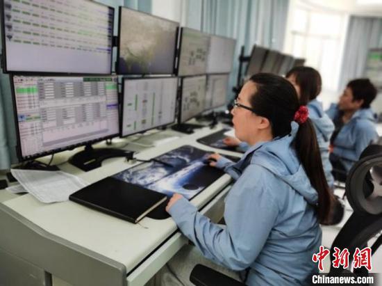
Engineers at the Miyun Station working on the first track data reception of the satellite. (Photo/ China News Service)
(ECNS) -- China Remote Sensing Satellite Ground Station (RSGS) has received data from the newly launched Atmospheric Environmental Monitoring Satellite, confirmed by Aerospace Information Research Institute, Chinese Academy of Sciences on Thursday.
The Miyun Station in Beijing successfully tracked and received the first-track downlink data from the satellite at 11:46 a.m. on April 21. Then, the Sanya Station in southern China successfully received data at 1: 17 p.m. and 2:55 p.m. as planned.
It took 24 minutes and 24 seconds to receive the 133 GB of satellite data, which were successfully processed.
The Atmospheric Environmental Monitoring Satellite was launched by a Long March 4C carrier rocket on April 16 from the Taiyuan Satellite Launch Center in north China’s Shanxi Province, and entered a sun-synchronous orbit 705 kilometers above Earth. It is the world’s first satellite using LiDAR (light detection and ranging) technology to detect carbon dioxide, or CO2.
The satellite is used to track fine particles, pollutants, greenhouse gases, clouds, aerosols in the atmosphere, as well as environmental elements such as land surfaces and water bodies. It provides data support for China's atmospheric environment monitoring, global climate change research, crop yield estimation, and agricultural disaster monitoring.
















 京公网安备 11010202009201号