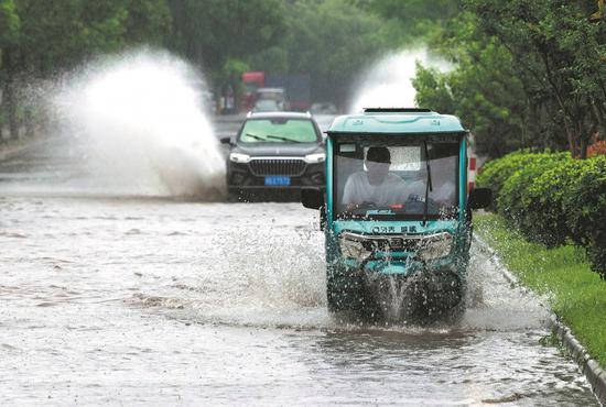
Vehicles splash their way along a flooded road following a rainstorm in Jinhua, Zhejiang province, on Monday. (HU XIAOFEI/FOR CHINA DAILY)
The first typhoon of the year in the northwest Pacific Ocean is expected to continue intensifying but will not have a direct impact on China's weather, a meteorological expert said on Monday.
Tropical Cyclone Ewiniar strengthened from a tropical storm on Sunday morning to a typhoon over Philippine coastal waters by Sunday evening, according to China's National Meteorological Center.
At 2 pm Monday, the typhoon's center was located east of the Philippines at 16.2 degrees north latitude and 123.2 degrees east longitude. It packed winds of up to 136.8 kilometers per hour near its center.
The typhoon is traveling northeast at 20 kilometers per hour and is likely to strengthen further, the center said. Chief forecaster Gao Shuanzhu said the typhoon's strength is expected to weaken within two days as it progresses toward higher latitudes and enters the westerlies, eventually transforming into an extratropical cyclone and dissipating within five days.
While Ewiniar has triggered landslides, heavy rainfall and casualties in the Philippines, Gao said the typhoon has not exhibited extreme winds and is not expected to have a direct impact on China. However, Gao said several parts of China can expect rainy weather in the coming days.
The National Meteorological Center renewed a yellow alert for heavy rainfall on Monday morning. It is the third-highest level in a four-tier warning system.
From Monday to Tuesday, eastern and southern areas, including the provinces of Fujian, Guangdong, Zhejiang, Yunnan, Sichuan and Anhui, can expect heavy to extreme rainfall. The center also forecast strong convective weather in those areas.












 京公网安备 11010202009201号