


As China experiences a much-higher-than-usual mobility of people during the Dragon Boat Festival holiday, a new wave of scorching heat, marking the strongest this year, is set to peak from Monday to Thursday in northern parts of the country, with temperatures in some places expected to hit record highs. In the south, torrential downpours will persist over the next three days, bringing risks of potential secondary disasters.
Saturday marked the onset of the strongest heatwave to hit northern China this year. Monitoring data indicated that on Saturday, multiple regions in North China's Hebei Province and Northwest China's Xinjiang Uygur Autonomous Region experienced scalding temperatures between 35-38 C, with some areas in Xinjiang's Turpan, known as China's "furnace," reaching 40.5 C.
The National Meteorological Centre (NMC) maintained a yellow heat warning on Sunday morning on the back of intensifying heat. Temperatures are expected to peak from Monday to Thursday, according to the NMC, noting that a wide swathes of Northern China will experience sustained temperatures of 40 C or above, potentially breaking records for this time of year.
This heatwave is considered unique for its wide impact, high intensity, and prolonged duration, the NMC noted. It reminded the public to take necessary precautions to avoid heatstroke and heat-related health issues.
Relief is expected from Friday onwards as a cold front moves southward, gradually alleviating extreme heat in the northern regions.
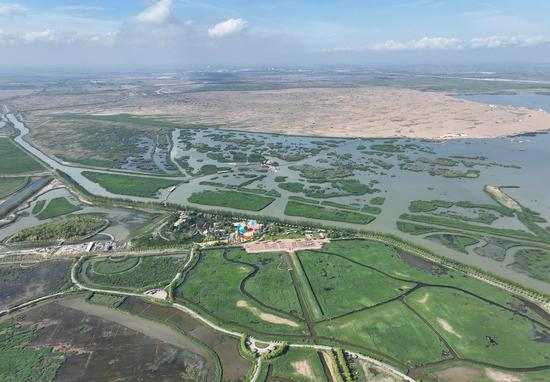
While north braces for heat, southern parts of the country are set to be drenched by relentless rainfall.
From Saturday to Sunday, NMC data showed that more than seven provincial-level regions in the south experienced heavy to torrential rain.
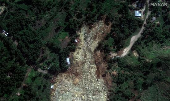
Over the next three days, the areas impacted by intense rainfall in the south will shift eastward and northward, primarily affecting northern parts of South China's Guangxi Zhuang Autonomous Region among others.
Local authorities in Guangxi initiated a level IV emergency response on Saturday in preparation for risks brought by the wide-reaching impact and intensity of the current round of rainfall. A level IV emergency response for hydrological monitoring and forecasting was also launched the same day as several stations on the local rivers exceeding the warning flood levels
The World Meteorological Organization (WMO) updated on June 3 that the El Niño event, which helped fuel a spike in global temperatures and extreme weather around the world starting from last year, is now showing signs of ending.
There is likely to be a swing back to La Niña conditions later this year, with at least 60 percent of chance experiencing La Niña during July to September, the WMO update said.
La Niña refers to the large-scale cooling of the ocean surface temperatures in the central and eastern equatorial Pacific Ocean, coupled with changes in the tropical atmospheric circulation, namely winds, pressure and rainfall, according to WMO.
While the effects of each La Niña event vary depending on a number of factors, in many locations, especially in the tropics, La Niña produces the opposite climate impacts to El Niño.
Data suggested that the past nine years have been the warmest on record even with the cooling influence of a multi-year La Niña from 2020 to early 2023. El Niño peaked in December 2023 as one of the five strongest on record.


 京公网安备 11010202009201号